About
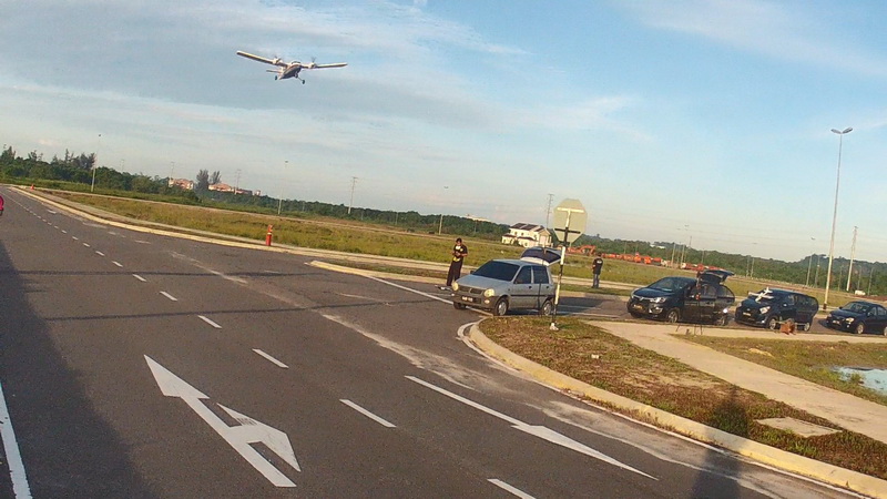
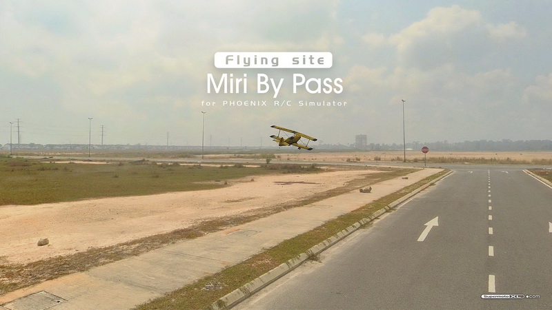
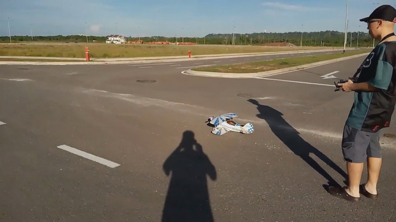
Welcome back to our current air field in 2026! If you've seen my previous recent RC flying activity then this is the place where our flying buddies hang out....almost all local RC flying hobbyist flock here every weekend to enjoy their activity. Usually we called this area as "Miri By Pass" because this site is located next to main highway trunk that by passes main town in straight line located outside MIRI City township. 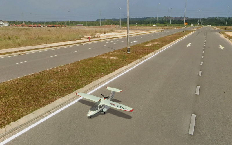 As in 2026 (at the time of writing/publishing) throughout the entire highway by pass beside the road there are lots of new plot of land under construction to modernized rural area into modern urban hence where we are right now at this open site. For us its an ideal place to meet up because its not far from our home and safe distance to fly away from crowded public places. The 'Cons' was this area is quite 'tight' to fly and limited to certain RC model could be flown in this site because the area to take-off and land is very narrow especially on the tarmac road with lots of elevated curbs, lots of light poles structure need to avoid and prohibited to fly FPV or drones because the site is located close proximity to the airport. Overall we only able to fly smaller size models with average wingspan below 3 meters, an electric powered or smaller nitro/gas models and fly below 30m altitude to keep the airspace safe. Unfortunately this is our temporary sanctuary to fly our RC models because our previous RC airfield that have was on an abandoned runway was taken over by commercial developer few years back. Luckily i was able to re-create the flying site into Phoenix RC simulator before it was completely torn down...you can download the site here (Click here). So we need to enjoy as much as we could around this site before the area fully develop and crowded...then we have to move on. Which is why i decided to create a 'virtual' digital version of this site into Phoenix RC simulator before its gone for good.
The build
Again just like previous build i will be using Google Street View to sourced the panoramic scene of that site. To extract the Google Street View panorama i will be using a special tool i've already created, its called: "GOOGLE STREET PANO-CUBE 360". This tool instantly extract panoramic street view from Google then Cube Map it into tiles, other option include image color editing and enhancement before import to file. That saved me a lot of work and free to use for all available through my app website (click here). This tool can output 4096x4096 pixel per-tile/cubemap which is good enough where in Pano format (Equirectangular panoramas) is 16384 x 8192 pixel for full scene.
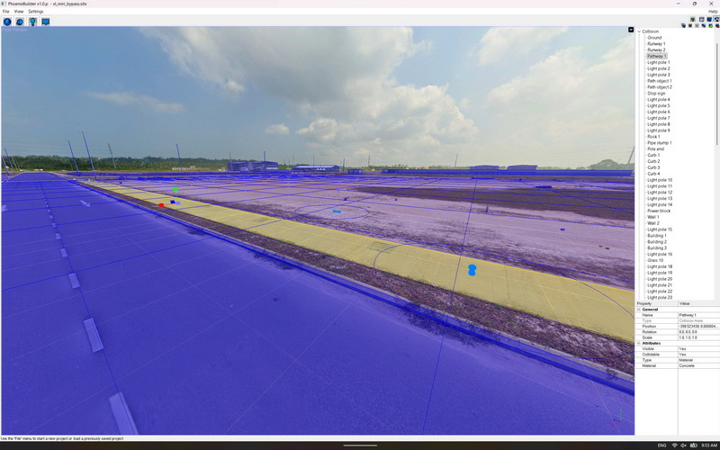
Through the tool extraction it exported 6x tiles that formed original cubemap properly renamed. All i have to do is to remove Google watermarks which takes sometime on Photopaint program since i have to edit manually. Next process as usual working on Phoenix Builder tools i have to line up the panorama tiles into Cubemap layout for a complete 360 sphere pano. Then put ground platform like grasses, adding elements such as lightings, object collisions, starting points and other attributes to make the virtual site works. Thanks for the early tools i created the whole project only took less than half day to complete.
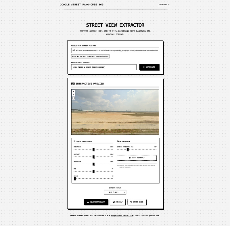
Tools used to create these custom site:
- Source of panorama photos: Google Street View
- Conversion tool for Google street view: Google Street Pano-Cube 360
- Site builder tool: Phoenix Builder
- Photo editing program: Corel Photopaint
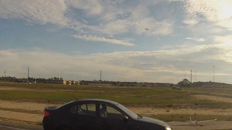
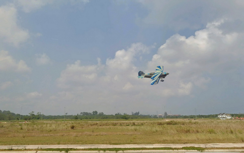
Actual real life flying site:
VR panoramic construction:
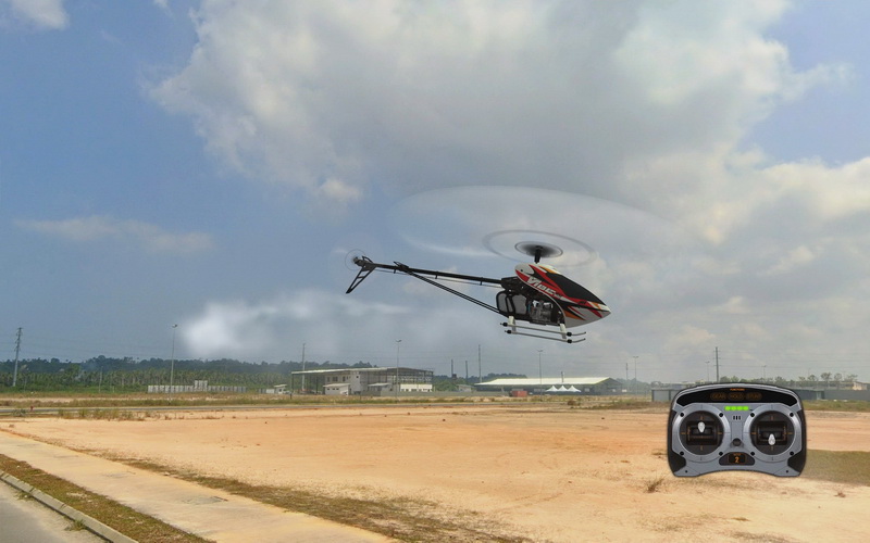
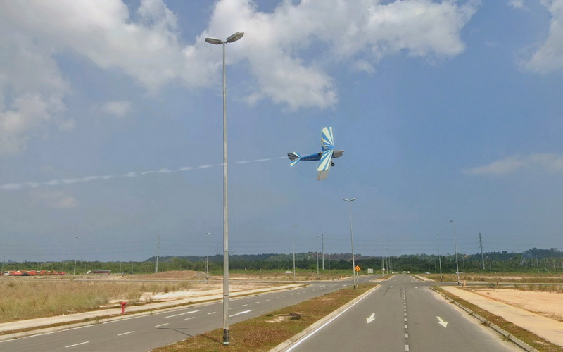
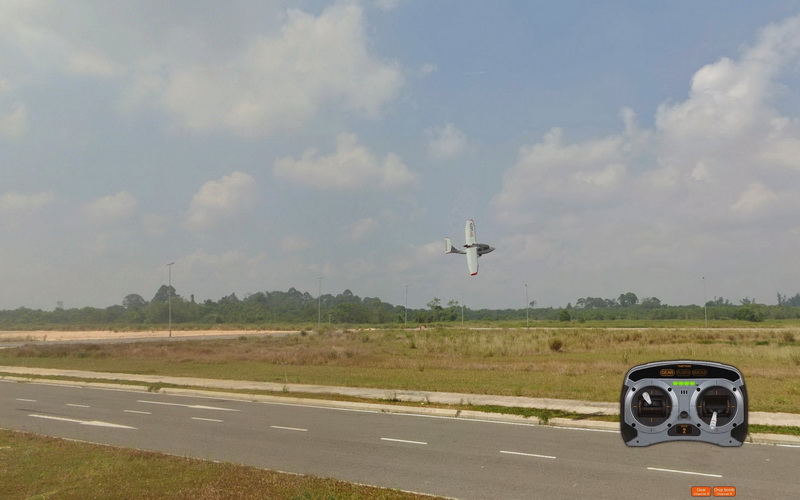
Virtual flying site in Phoenix R/C simulator:
Flying site characteristic
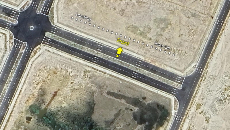
This area definately not a good place for those who start to learn how to fly an RC model...looks like huge open air to fly but in between there lots of structural obstacles to dodge and that include once the model on the ground....this is much expected on a site where its going to turn into residental and commercial lot soon in the future. It has very usable 100m long runway to take off on small to medium size flight models. Once in the air the site has large 600m (length) x 150m (width) of usable flying air space to roam about in the skies but by practise in real life we flew below 30m height because of close proximity to the airport. The challenges i have to face flying in this site was trying to avoid multiple amounts of light poles surroundings the area when in the air, trying to take off on narrow tarmac road, avoid colliding with the road curbs and also bumpy terrain if trying trying to take-off and land on unpaved/grassy lot. From our standing point of view in the sim (when you start spawn on the spot) we usually take-off from left to right because the morning wind came from our right side towards the left which happened early in the morning thus indicated the actual sunrise on our right top side in the continent where we live. Overall its not a good place for a beginner to fly their planes which is why most of us who flew in this areas is either between intermediate and advance level RC pilot.
Flying site specification:
- Area type: Under construction residential & commercial lot.
- Google map location: https://maps.app.goo.gl/Cug2QoZRTnMnWBZF8
- Field size: Approximately 311m (length) x 280m (width) of usable flying air space.
- R/C model flight suitability: Small/medium scale propeller driven nitro/gas engine plane, electrics, helicopter and EDF planes.
- Safe take-off & landing runway length: 100m clearance (both on rough field and tarmac road)
- Hazards & obstacles: Light poles, road curb and narrow roads.
- Flight skills required: Intermediate to Advanced.
Summary
We started to fly close proximity around this area since 2022 on the dirt field across this area down to the east side but we got 'shove off' towards this area in 2024 after developer started to add clean tarmac road and access to cars to enter this place. Since then more and more of our local flying buddies started to flock together equivalent to the same size of crowds we used to have more than10 years ago at old Lutong Runway (our original RC airfield) before been drove out by commercial land developer. It's good to see some of our 'oldies' back together flying but not much variety of serious RC models showing up in the air because of the flying site characteristic and terrains limits what model we could fly. Ironically not only us RC model hobbiyist flock to this are but other club like kite flyer club and other related activities that used to congregate old "Lutong Runway" decades ago started to show up at that very same place we are in but at different time slot. Its very sad to say our local town/city council doesn't support much to local clubs who in need of site to cater this positive and healthy social activity...this translate a lot in East Asian culture where a big piece of land is commercial "premium" where people's health recreational need is at lower bottom feed priority.......except 'Golf Club Field' for the minority...ultra ironic!. This is why every time you see any East Asian RC flying community flock together to fly RC model shown in social media video its always in a 'random' area which is not properly designated or 'go rougue' to certain places. Regardless we as RC hobbyist will try our best to enjoy what's available at minimal hence "Ah! this place is good enough for now" thingy. We all know this "Miri By Pass" flying site will be gone soon but at least i manage to capture it into digital format so it can be forever be remembered as our nostalgia and able to enjoyed 'virtually' in simulator later. Enjoy flying!
Video
General info | site model: Miri By Pass | platform: PC | simulator version: Phoenix R/C v5.5 | type: Flying site | avg ZIP file size: 35.7MB | date released: 25-Sept-2026 | Revision: v1.0
 Full gallery preview | Video preview |
  Download this Phoenix R/C flying site
*Installation instruction: How to install custom site in Phoenix R/C
*Note: This virtual flying site are available for free distribution and for non-commercial purposes.
*Credits: Panorama sources are from Google Map + Google Street View.